VMRC Maps: Location Aid App
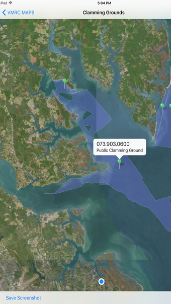
VMRC Maps is an iPhone application designed to assist users in determining their position in relation to various mapped areas. These include private oyster ground leases, oyster ground applications, fixed fishing devices, public clamming grounds, and the blue crab sanctuary. The app aims to provide location accuracy within approximately 50 feet of the user's actual location, especially for GPS-equipped devices. It functions offline and updates map data every five days when connected to a network, ensuring relatively current maps even without an active connection.
The app comes with a standard disclaimer, emphasizing that the GIS data may not always be entirely accurate or complete. Users are reminded to comply with all regulations when using the app for harvesting and navigation purposes. It is recommended to verify data usage with the Marine Resources Commission and/or VDH Division of Shellfish Sanitation personnel before making decisions based on the app's data, particularly for regulatory and permitting processes.